|
Today |
Tonight |
|
Scattered Storms 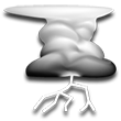 HIGH: 87° HIGH: 87°
Chance of Precip: 73%
UV Index: 7
Mostly Cloudy with Thunderstorms Likely. Winds WSW at 17 to 23 mph.
|
Isolated Storms  LOW: 79° LOW: 79°
Chance of Precip: 21%
Partly Cloudy with Showers and Isolated Storms. Winds WSW at 12 to 18 mph.
|
|
Tomorrow |
Tomorrow Night |
|
Mostly Sunny  HIGH: 88° HIGH: 88°
Chance of Precip: 0%
UV Index: 10
Mostly Sunny. Winds NNW at 6 to 13 mph.
|
Isolated Storms LOW: 80°
Chance of Precip: 17%
Partly Cloudy with Showers and Isolated Storms. Winds WSW at 8 to 12 mph. |
|
Tuesday |
Tuesday Night |
|
Mostly Sunny HIGH: 88°
Chance of Precip: 0%
UV Index: 10
Mostly Sunny. Winds WNW at 4 to 11 mph. |
Mostly Clear 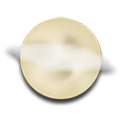 LOW: 82° LOW: 82°
Chance of Precip: 0%
Mostly Clear. Winds SW at 7 to 11 mph.
|
|
Wednesday |
Wednesday Night |
|
Mostly Sunny HIGH: 88°
Chance of Precip: 0%
UV Index: 10
Mostly Sunny. Winds WSW at 4 to 10 mph. |
Isolated Storms LOW: 81°
Chance of Precip: 11%
Partly Cloudy with Showers and Isolated Storms. Winds S at 6 to 10 mph. |
|
Thursday |
Thursday Night |
|
Showers  HIGH: 88° HIGH: 88°
Chance of Precip: 15%
UV Index: 10
Partly Cloudy with Showers. Winds SSE at 2 to 9 mph.
|
Isolated Storms LOW: 81°
Chance of Precip: 10%
Partly Cloudy with Isolated Storms. Winds SE at 5 to 9 mph. |
|
Friday |
Friday Night |
|
Isolated Storms 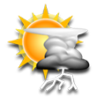 HIGH: 88° HIGH: 88°
Chance of Precip: 15%
UV Index: 0
Partly Cloudy with Isolated Storms. Winds ENE at 4 to 11 mph.
|
Showers 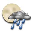 LOW: 81° LOW: 81°
Chance of Precip: 23%
Partly Cloudy with Showers. Winds SSE at 4 to 8 mph.
|
|
Saturday |
Saturday Night |
|
Isolated Storms HIGH: 86°
Chance of Precip: 13%
Precip Amount: 0.02"
UV Index: N/A
Partly Cloudy with Isolated Storms. Winds ENE at 4 to 12 mph. |
Isolated Storms LOW: 83°
Chance of Precip: 13%
Precip Amount: 0.02"
Partly Cloudy with Isolated Storms. Winds SE at 6 to 10 mph. |
|
Sunday |
Sunday Night |
|
Isolated Storms HIGH: 86°
Chance of Precip: 13%
Precip Amount: 0.14"
UV Index: N/A
Partly Cloudy with Isolated Storms. Winds ENE at 4 to 12 mph. |
Isolated Storms LOW: 83°
Chance of Precip: 13%
Partly Cloudy with Isolated Storms. Winds SE at 6 to 10 mph. |
|
Monday |
Monday Night |
|
Showers HIGH: 86°
Chance of Precip: 100%
Precip Amount: 0.14"
UV Index: N/A
Partly Cloudy with Showers. Winds WSW at 3 to 11 mph. |
Showers LOW: 84°
Chance of Precip: 55%
Precip Amount: 0.02"
Partly Cloudy with Showers. Winds S at 6 to 11 mph. |
|
Tuesday |
Tuesday Night |
|
Showers HIGH: 86°
Chance of Precip: 55%
Precip Amount: 0.02"
UV Index: N/A
Partly Cloudy with Showers. Winds WSW at 4 to 11 mph. |
Isolated Showers LOW: 84°
Chance of Precip: 100%
Precip Amount: 0.17"
Partly Cloudy with Isolated Showers. Winds SSW at 7 to 11 mph. |
|
Wednesday |
Wednesday Night |
|
Isolated Showers HIGH: 87°
Chance of Precip: 100%
Precip Amount: 0.12"
UV Index: N/A
Partly Cloudy with Isolated Showers. Winds WSW at 4 to 13 mph. |
Mostly Clear LOW: 84°
Chance of Precip: 0%
Mostly Clear. Winds SSW at 9 to 13 mph. |
|
Thursday |
Thursday Night |
|
Partly Cloudy  HIGH: 85° HIGH: 85°
Chance of Precip: 0%
UV Index: N/A
Partly Cloudy. Winds WSW at 7 to 14 mph.
|
Showers LOW: 83°
Chance of Precip: 11%
Precip Amount: 0.01"
Partly Cloudy with Showers. Winds SSW at 8 to 8 mph. |
|
Friday |
Friday Night |
|
Mostly Sunny HIGH: 84°
Chance of Precip: 0%
UV Index: N/A
Mostly Sunny. Winds W at 6 to 9 mph. |
Mostly Cloudy  LOW: 83° LOW: 83°
Chance of Precip: 0%
Mostly Cloudy. Winds SSW at 9 to 10 mph.
|
|
Saturday |
Saturday Night |
|
Partly Cloudy HIGH: 84°
Chance of Precip: 0%
UV Index: N/A
Partly Cloudy. Winds NW at 7 to 10 mph. |
Partly Cloudy  LOW: 83° LOW: 83°
Chance of Precip: 0%
Partly Cloudy. Winds SSW at 8 to 11 mph.
|


 1
1 2
2 3
3 4
4 5
5 6
6 7
7 8
8